B. The Crags Coastal Reserve is an indigenous cultural site registered on the National Estate. The area features ancient aboriginal middens, cultural burial sites and important dream-time stories. Six kilometers off the coast is Lady Julia Percy Island. It is Australia's only offshore volcano. The Koori term for it is Deen Mar. The Aboriginal people of the region believe that the spirits of the dead were conveyed across the sea to the island from a cave called Tarnwirring ("the flowing of the wind") at the top of a rocky sea cliff. It contains an important seal breeding colony and has a long history of human exploitation, which has drastically affected its vegetation communities, though it is now protected as a State Faunal Reserve.
C. Portland is the oldest European settlement in the state of Victoria, but the Gunditjmara are the original custodians of the land. There is a deep water port and aluminum (or as they say here aluminium) and timber are major industries. On the second picture you can see the local tourism trolley rolling by the marina with the lumber mill in the background.
D. The Beachport Jetty, created after a number of ship wrecks, was originally 4000 feet long but part of it was not constructed adequately, and it is now only 2536 feet. Construction was completed in 1882 and it took 4 years to build. The aquamarine colors here were just spectacular. The picnic tables were old re-purposed rail carts used to unload cargo back in the day.
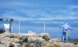
E. During the Victoria gold rush around 1857, over 16,000 Chinese immigrants landed at Robe and then walked the 200 miles "up country" to Ballarat and Bendigo to work. The red and white obelisk was erected in 1852 and was used to navigate the entrance to Guichen Bay, as well as to store lifesaving equipment. The land beneath the obelisk is eroding, hence all of the protective fencing, and it is unknown how long it will continue to stand.
 |
| It's a long way down... |
F. The Coorong is a national park and lagoon ecosystem that is a sanctuary for many birds, animals, and fish. The name is thought to come from the local indigenous people's word kurangh, meaning "long neck"; a reference to the shape of the lagoon system. The name is also thought to be from the Aboriginal word Coorang, "sand dune," a reference to the sand dunes that can be seen in the bay. The body of water in these pictures is the bay that is between a 130 km long peninsula and the coast. On the other side of that land in the distance is the ocean. We had hoped to see many pelicans here as it is a regular roost, but we only saw a few fly overhead. In 2008, biologists banded 1500 pelicans and they learned that pelicans eat approximately 5 kilos of fish a day - according to Andy's maths, that's 7,500 kilos of fish a day!
G. The Glenelg Beaches in Adelaide are the white sandy beaches of travel brochures. There was thunder and lightning around us but we only experienced a few raindrops and it made for a dramatic beach walk. The coast is built up quite a bit with high rise hotels and many people were swimming despite the somewhat inclement weather.


No comments:
Post a Comment